Proximity Searching
Azimap allows several
ways to analyse your data, one of the simplest being the proximity search tool. It’s an easy search to run and can be used
for so many purposes, for example, planning purposes. It can tell you what lies
beside a certain feature within a given radius. e.g. Certain roadworks or
building projects mightn’t be allowed to take place within a certain distance
from a school, electricity, sewer, road, etc.
This guide will take
you through how to get started with your proximity search and generate a
report.
Contents
1. Activate your proximity search
2.
Generate
a report
1.
Activate your proximity search
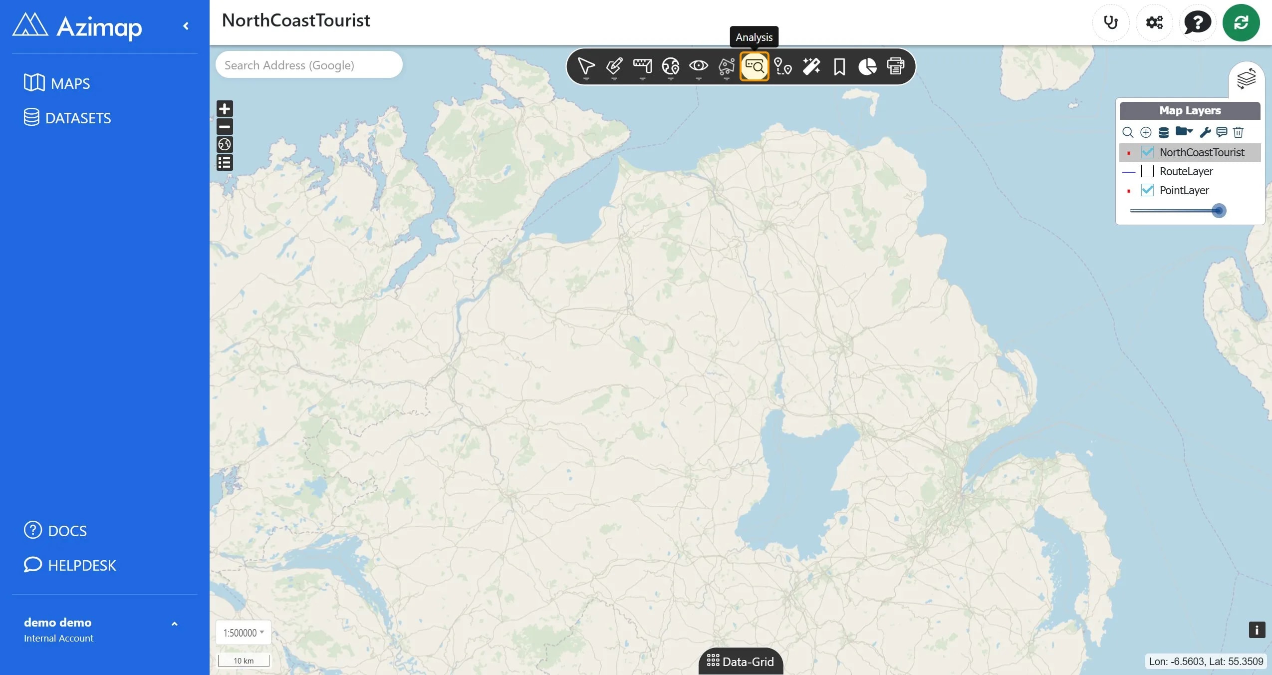
To find the Proximity Search button, first click the Analysis button on the toolbar. It will be the fourth icon from the end 
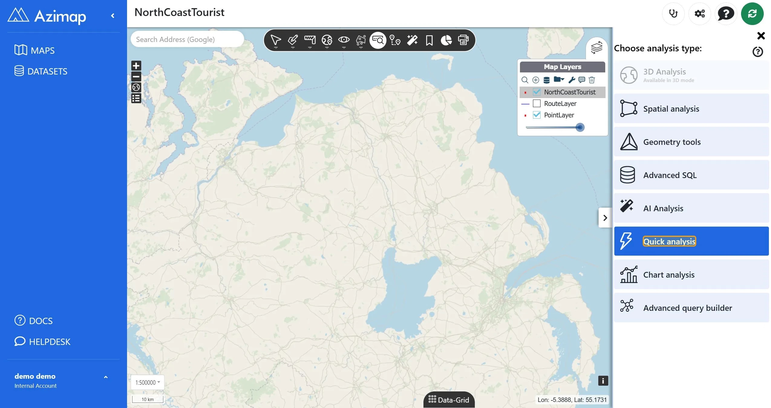
From the menu, choose the Quick Analysis option.
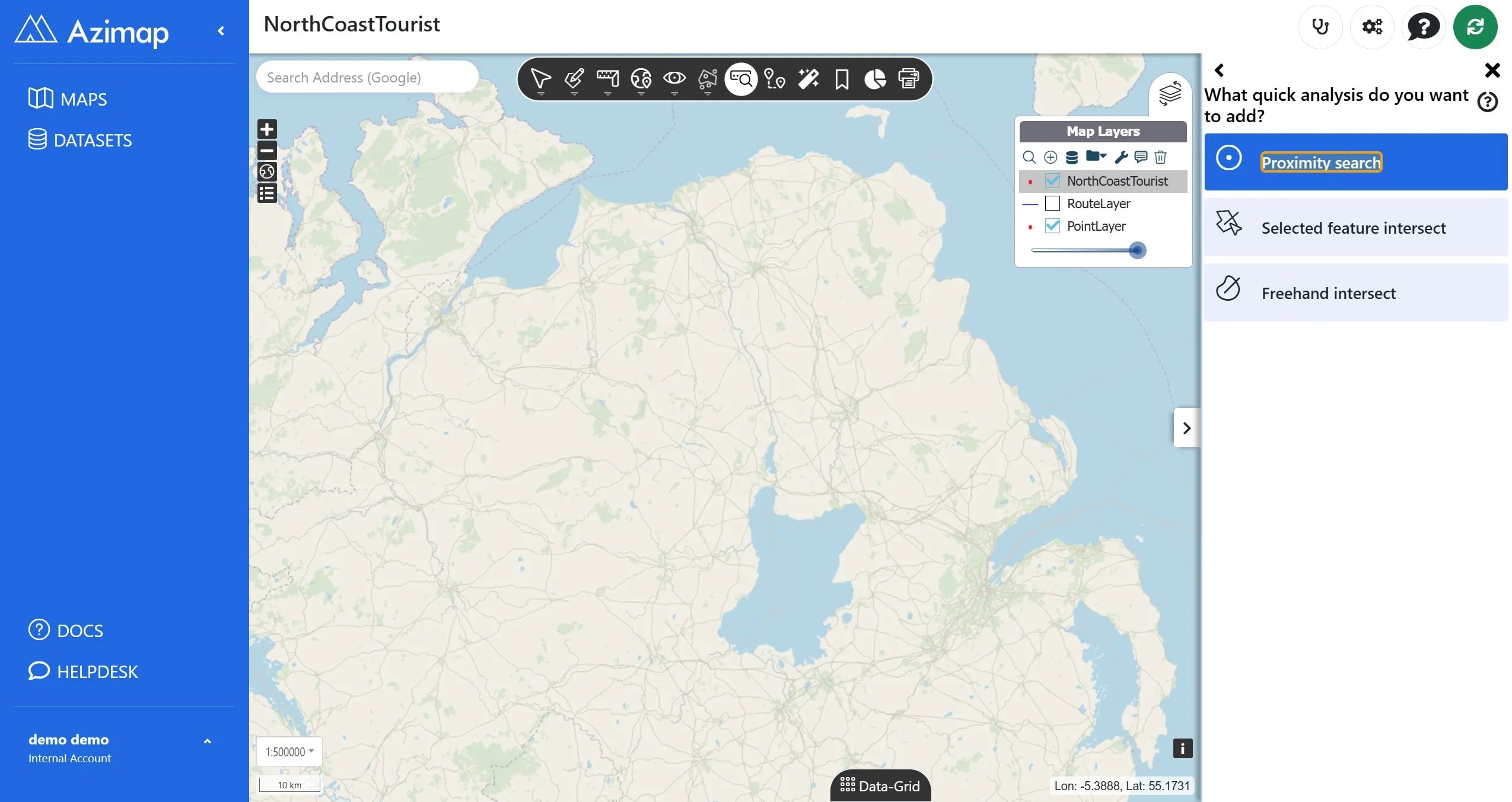
In the next sub-menu, choose Proximity Search.
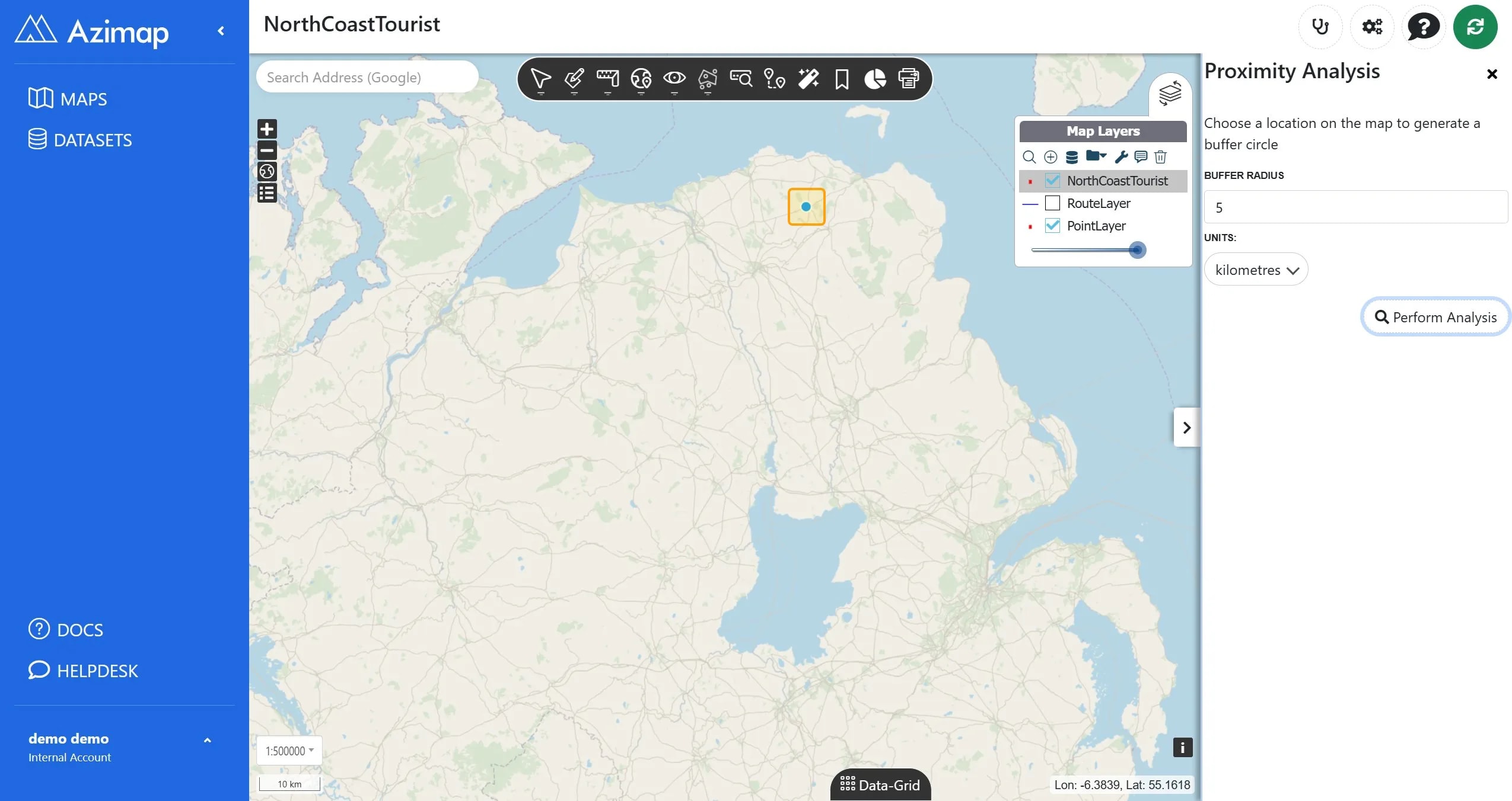
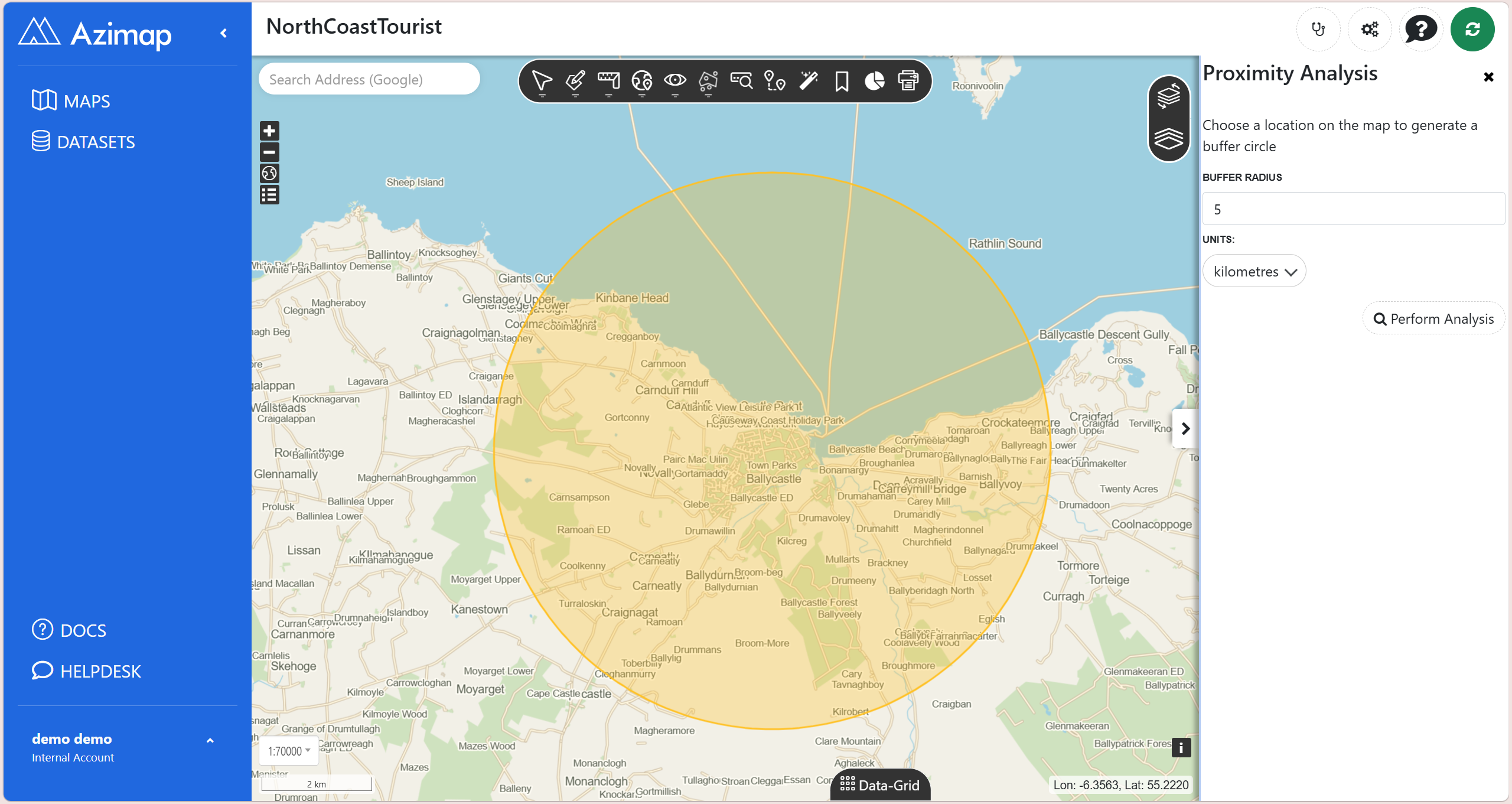
A pop-up analysis window will appear on the right of your screen.
You can then input the details of your proximity search and press the Perform Analysis button.
When you press the Perform Analysis button, it pulls up your report like below.
Thanks for reading and if you haven't yet tried Azimap please go to
the website and press REGISTER.