Link
to Existing Data in an External Spatial Database
Azimap allows
connecting to existing spatial tables within your infrastructure. Currently the
application supports MS SQL Server 2008 R2+ and PostgreSQl 9.4+.
To do this please
follow the simple instructions below.
1.
Create a new layer
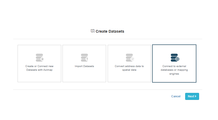
Within the main window, choose the "Datasets" window.
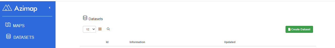
Select CREATE DATASET and then choose CONNECT TO EXTERNAL DATABASES OR MAPPING ENGINES then press NEXT.
1.1.
Using the database connection builder
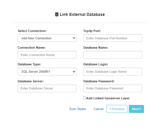
You will be presented
with a database connection builder. Please fill in the connection details of
the required database. All details entered are stored for later use in an
encrypted format.
Select your schema to
see a list of spatial layers or views. Where possible, Azimap will auto select
all other settings based on the table information.
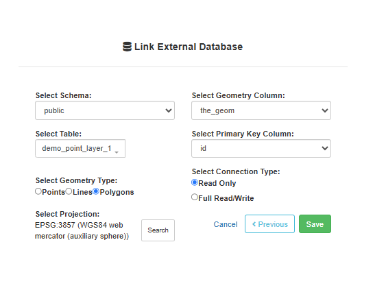
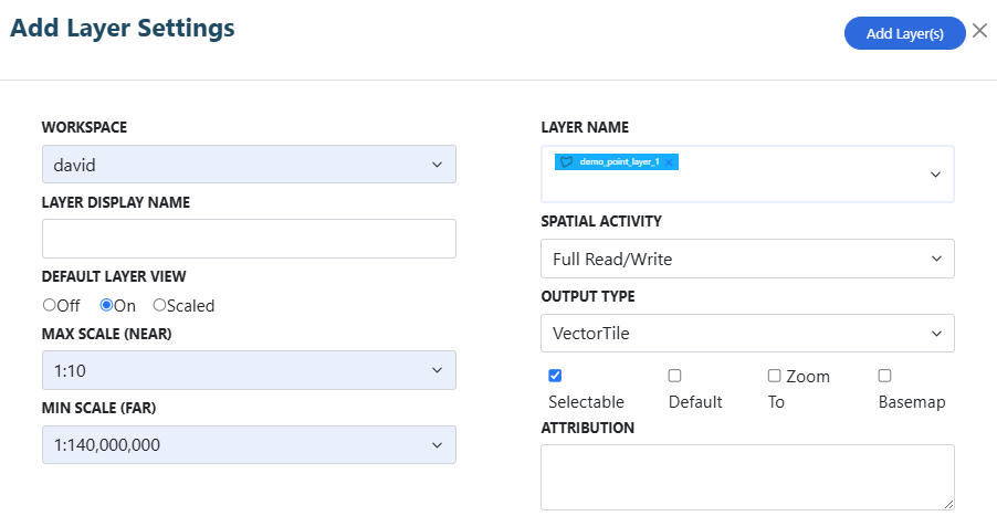
Click SAVE to add the
new layer to Azimap. The layer will now appear as a configurable layer in
Azimap for adding to maps and applications.
Happy mapping!
To register for a free trial with Azimap, head to azimap.com now and hit REGISTER.