Azimap does its best to automatically choose the correct projection for any imported data, however if the system can't work out the projection or the user chooses the incorrect projection system on import then your data can end up in the wrong location.
Some ways to ameliorate this are:
CSV - look at the data, if it contains X,Y and the data is between 180 and -180 then your data is in WGS84 EPSG:4326 or one of its derivatives.
Consider your own location, the data may be in your national projection system -
- For UK that is British Grid (BG) - EPSG:27700
- In Ireland it could be Irish Transverse Mercator (ITM) - EPSG:2157 or one of the older Irish Grids (IG) - TM75 EPSG:29903 or TM65(Depreciated) EPSG:29900
- In the USA there are multiple possible local projections systems to choose from
If you have the well-known text projection information for your dataset you can utilise the Azimap hosted OpenGeo developed PRj2epsg website which allows you to sear h for an applicable EPSG code.
If you data contains XYs or Easting/ Northing you can utilise our multi-coordinate search within any map.
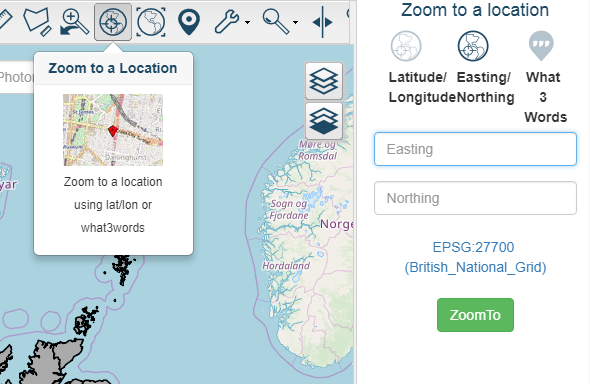
With this tool you can search for coordinates in any worldwide projection, try a search in a likely projection and see if it takes you to the correct location.
If all esle fails contact us at enquires@azimap.com or on the website form and we will try to assist you in identifying the correct projection system for your data.