Add Linked Geoserver Layers
If you are an Enterprise customer with an existing
infrastructure set-up using Geoserver.
Azimap can be directly plugged into this infrastructure and allows for the
creation of 'linked GeoServer' layer type giving you the full power of Azimap
to map and edit the data of the existing GeoServer layers.
Time to complete: 10 mins
Contents
1. Create
a new layer
1.1. Using
the database connection builder
1.2. Choose
your existing Geoserver datasets
1. Create
a new layer
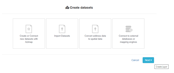
Select CREATE DATASET and then choose CONNECT TO EXTERNAL DATABASES OR MAPPING ENGINES.
1.1. Using
the database connection builder
You will be presented with a database connection builder. Please
fill in the connection details of the required database. All details entered
are stored for later use in an encrypted format. Alternatively you can choose
an existing connection. Make sure that the 'Add Linked GeoServer Layer' is
checked.
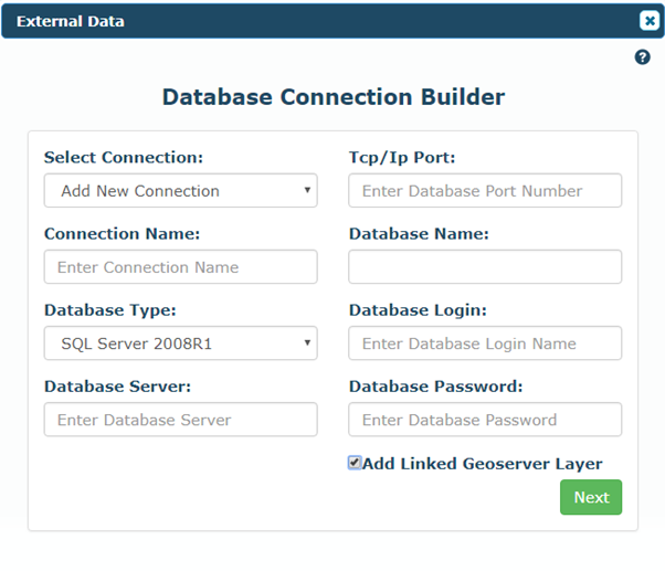
Click NEXT to choose your existing GeoServer datasets. You will
be presented with the option to select any workspace/ datastore which utilises
the appropriate connection string as chosen above.
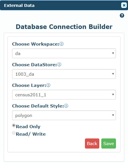
1.2. Choose
your existing GeoServer datasets
Select the applicable workspace, then datastore, then layer and
style to add to Azimap. Layers can be added READ ONLY or READ/WRITE.
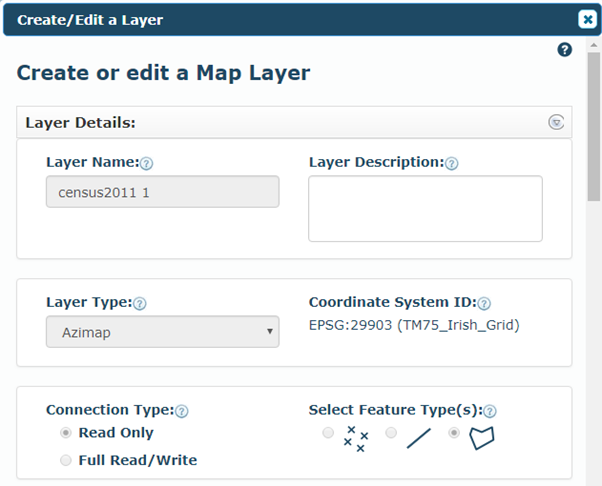
The layer is now added to be used however you want to within
Azimap
Happy mapping!